|
Teaching Slides: Causation
|
|
Here are teaching slides for "Causation".
You can see a full-size version by clicking on the thumbnail. You can then
download that slide individually
by simply dragging it to your desktop.
|
|
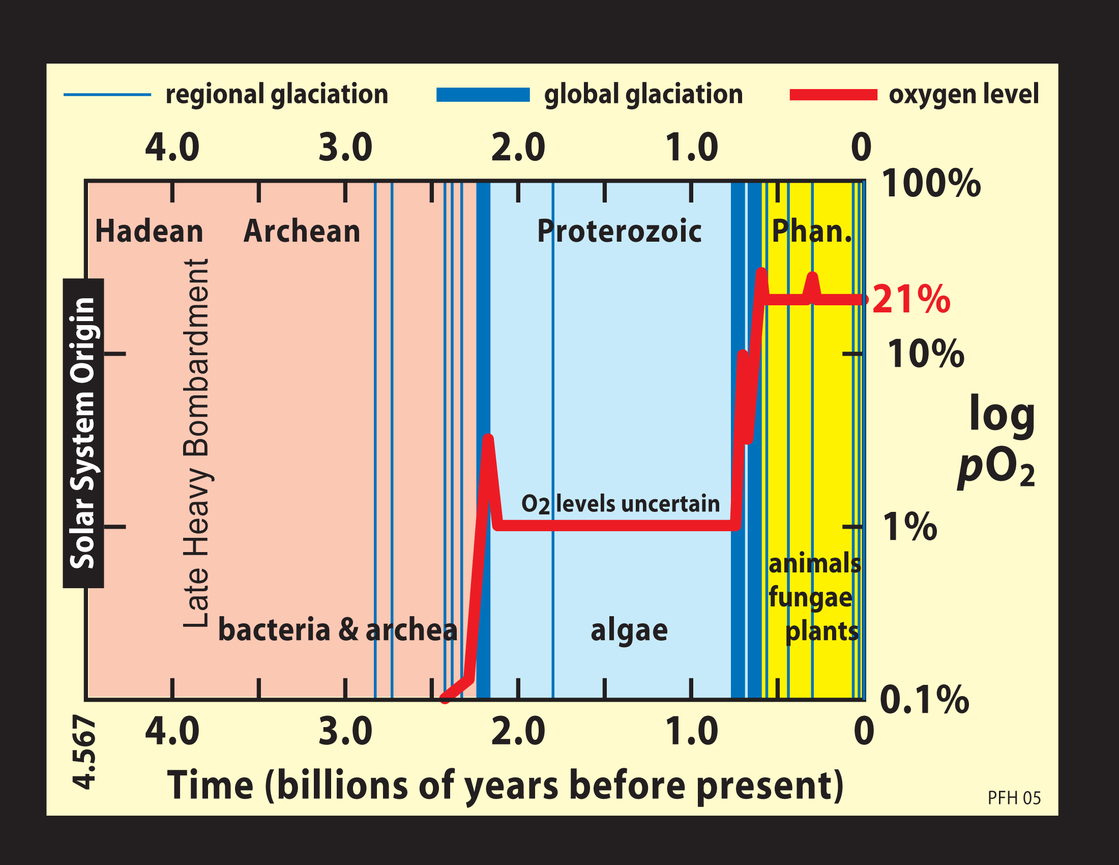
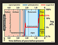 | 13.2:
Postulated rise in atmospheric oxygen over geologic time, and its relationship
to ice ages (blue bars) and biospheric evolution. If the step-like rises
in oxygen were rapid, consequent destruction of atmospheric methane (a
powerful and potentially major greenhouse gas in the early atmosphere)
could account for the Makganyene and Sturtian snowball earths. If the oxygen
rises were slow (millions of years), methane destruction might be offset
by CO2 rise modulated by silicate weathering feedback. The Marinoan
snowball earth, coming <75 Myr after the Sturtian, is more difficult
to attribute to methane destruction, requiring a methane-oxygen see-saw.
|
|
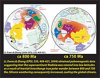 | 13.3:
Li et al. (2004) postulated that a polar mantle superplume, located beneath
the India-Australia-South China part of the Rodinia supercontinent, rotated
to the equator between 800 and 750 Ma as a result of true-polar-wander
(TPW). They suggest that increased silicate weathering due to the paleogeographic
change caused the global climate to cool. (TPW refers to a bodily rotation
of the entire silicate shell (mantle and crust) of the Earth with respect
to the rotation axis, which is assumed to be fixed in the celestial reference
frame. TPW is a response to changes in mass distribution [inertial tensor
figure] of the Earth associated with mantle convection).
|
|
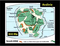 | 13.4:Paleogeographic
reconstruction of the Rodinia supercontinent at 800 Ma (Torsvik, 2004).
It is widely accepted that a supercontinent centered on equatorial Laurentia
existed from ~1000-800 Ma, but the relative locations of the extra-Laurentia
continents remain uncertain.
|
|
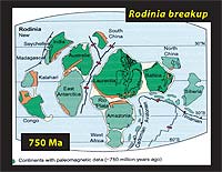 | 13.5:
Breakup and dispersal of the Rodinia supercontinent in a 750-Ma reconstruction
(Torsvik, 2004). Paleomagnetic data from 800-750 Ma exist for Laurentia,
Baltica, South China, Australia, India and Congo, but none for Kalahari,
East Antarctica, Rio Plata, Amazonia, West Africa, North China and Siberia.
Such data can constrain paleolatitude and paleodeclination, but not paleolongitude.
|
|
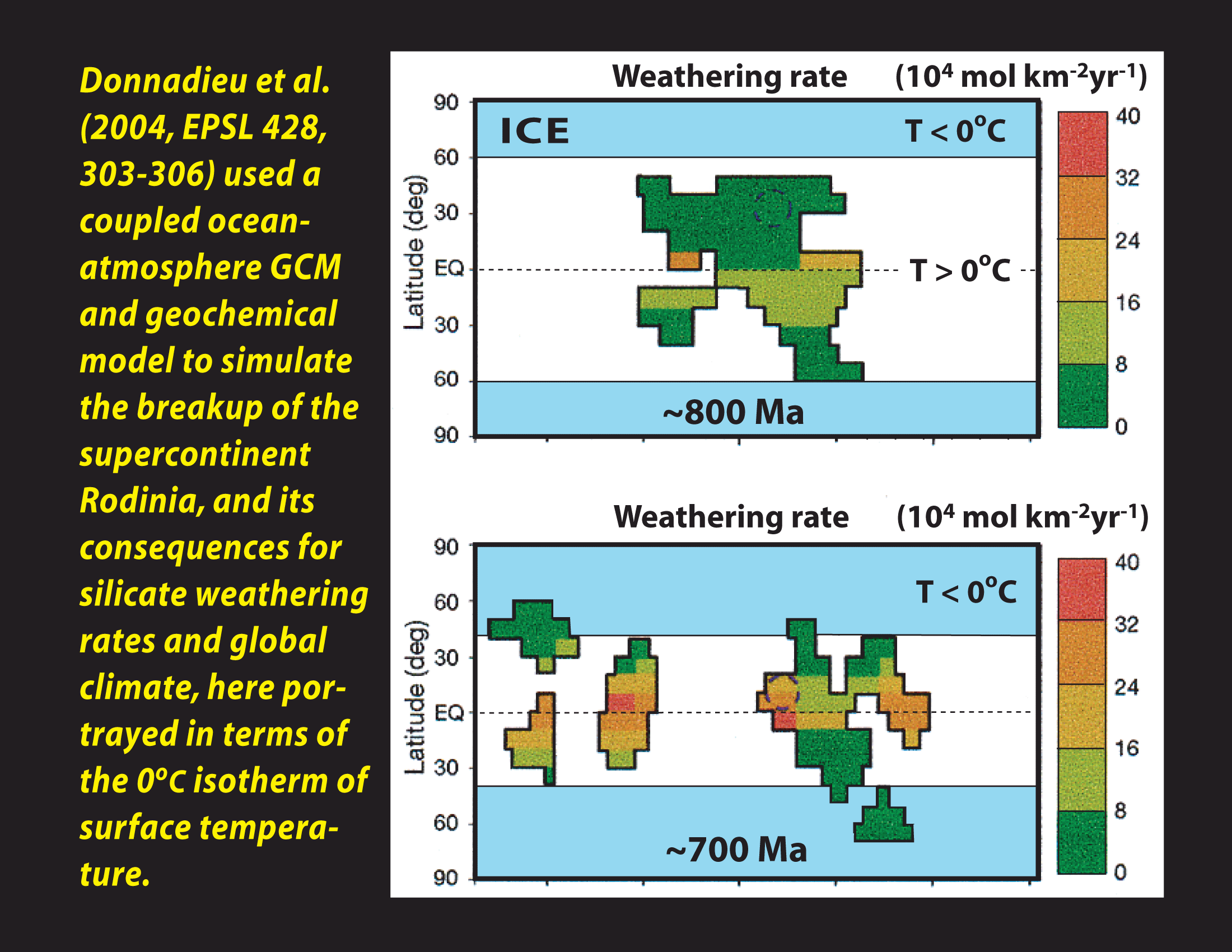
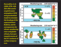 | 13.6:
Coupled climate-geochemical model of the breakup and dispersal of Rodinia,
800-700 Ma, in which the 0° isotherm migrates equatorward in response to
increased silicate weathering, primarily due to higher precipitation in
previously arid regions (Donnadieu et al., 2004).
|
|
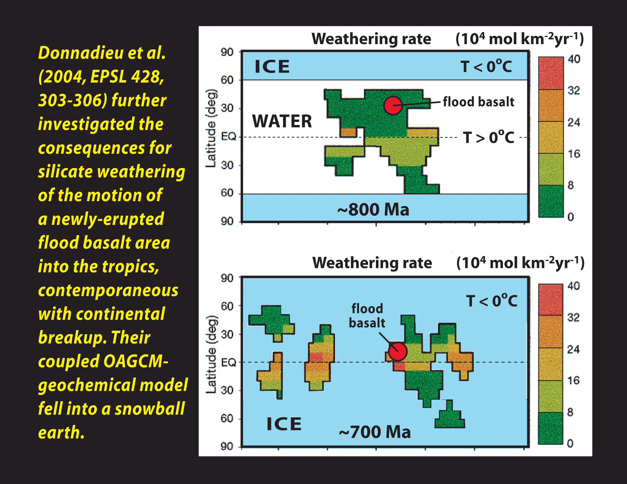
 | 13.7:
Same as the last slide, but with the addition of a flood basalt emplaced
at 780 Ma in the subtropics and tectonically rotated into the tropics (Donnadieu
et al., 2004). The additional weathering when the flood basalt entered
the tropics caused the model to lapse into the snowball state. The 723-Ma
Natkusiak flood basalt was in fact erupted near the equator, and could
have played an immediate causative role in the Sturtian snowball earth
without any tectonic rotation.
|
|
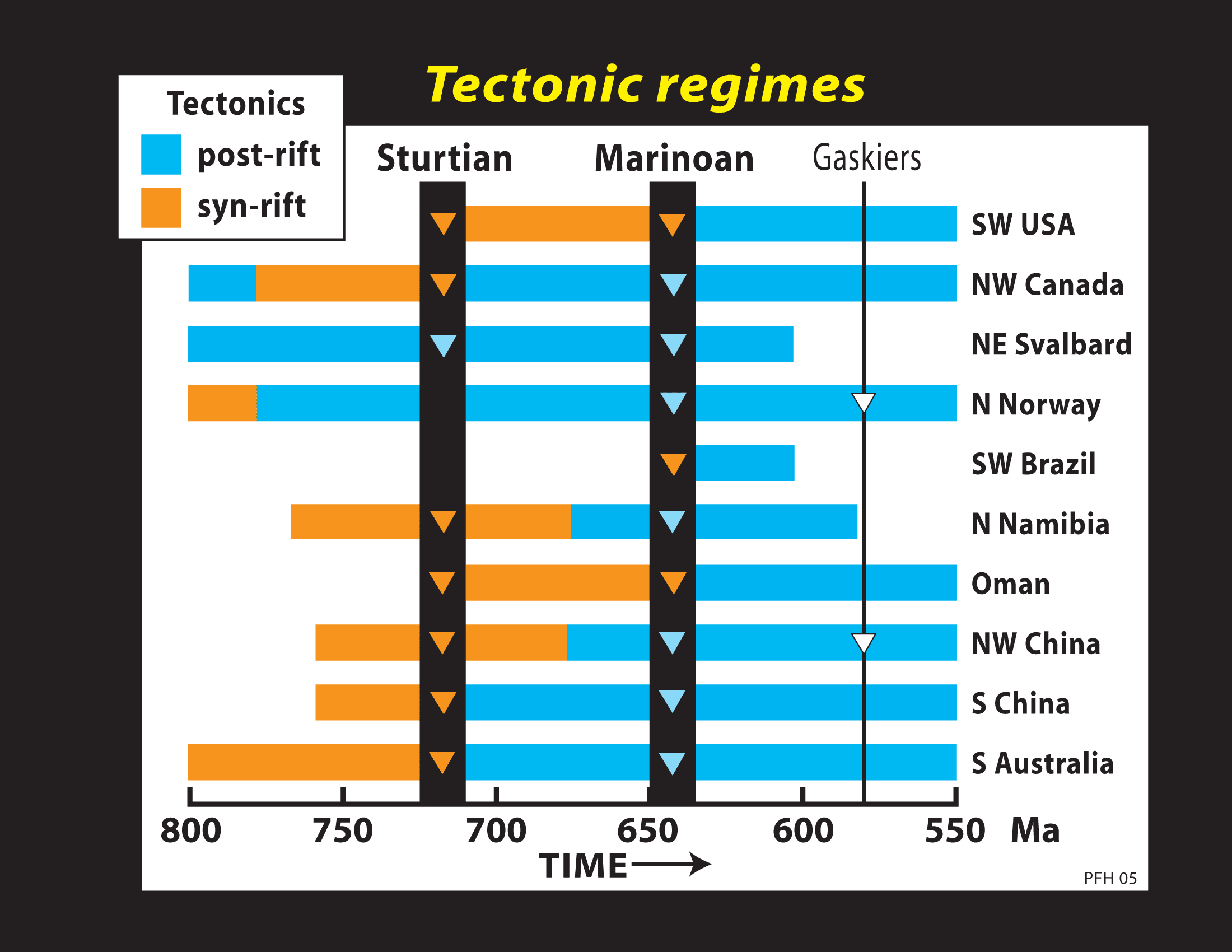
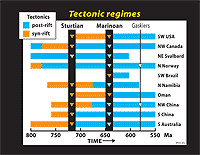 | 13.8:
Tectonic settings (syn-rift or post-rift) over time of selected Neoproterozoic sedimentary successions hosting multiple glacigenic intervals.
|
|